An unusual house number plate
Introduction
The photograph on this page of An unusual house number plate by Stephen Craven as part of the Geograph project.
The Geograph project started in 2005 with the aim of publishing, organising and preserving representative images for every square kilometre of Great Britain, Ireland and the Isle of Man.

There are currently over 7.5m images from over 14,400 individuals and you can help contribute to the project by visiting https://www.geograph.org.uk
An unusual house number plate
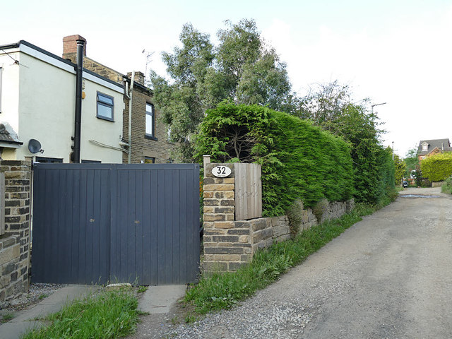
Image: © Stephen Craven Taken: 15 Jun 2020
The owner of 32 Penfield Road has acquired what appears to be an old railway bridge plate, as it bears the distance 183 miles 33 chains. A bit of detective work suggests this may have adorned a bridge over Gelderd Road on the former LMSR route into Leeds at Image That bridge has long since been demolished, so this appears to be a legitimate souvenir.
Images are licensed for reuse under creativecommons.org/licenses/by-sa/2.0
Image Location


Leaflet Map data © OpenStreetMap
Latitude
53.753004
Longitude
-1.656614