Arch and old wall, off Holly Atterton Walk
Introduction
The photograph on this page of Arch and old wall, off Holly Atterton Walk by Jeff Gogarty as part of the Geograph project.
The Geograph project started in 2005 with the aim of publishing, organising and preserving representative images for every square kilometre of Great Britain, Ireland and the Isle of Man.

There are currently over 7.5m images from over 14,400 individuals and you can help contribute to the project by visiting https://www.geograph.org.uk
Arch and old wall, off Holly Atterton Walk
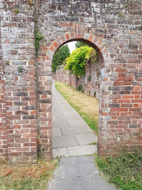
Image: © Jeff Gogarty Taken: 6 Jun 2020
It leads to Servite Close. The old walls interested me and a wondered what was behind them and it turns out it is just back gardens of Highlands Avenue. Bognor Regis has several walks leading between the streets. I have been informed that these walls used to enclose a Nunnery of a closed order. There is a plaque at a small cemetery on the corner of Servite Close and Hawthorn Road honouring 25 sisters of the Servite Order that are buried there.
Images are licensed for reuse under creativecommons.org/licenses/by-sa/2.0
Image Location
Latitude
50.788715
Longitude
-0.683282