Derelict barn, South Stainmore
Introduction
The photograph on this page of Derelict barn, South Stainmore by Andy Waddington as part of the Geograph project.
The Geograph project started in 2005 with the aim of publishing, organising and preserving representative images for every square kilometre of Great Britain, Ireland and the Isle of Man.

There are currently over 7.5m images from over 14,400 individuals and you can help contribute to the project by visiting https://www.geograph.org.uk
Derelict barn, South Stainmore
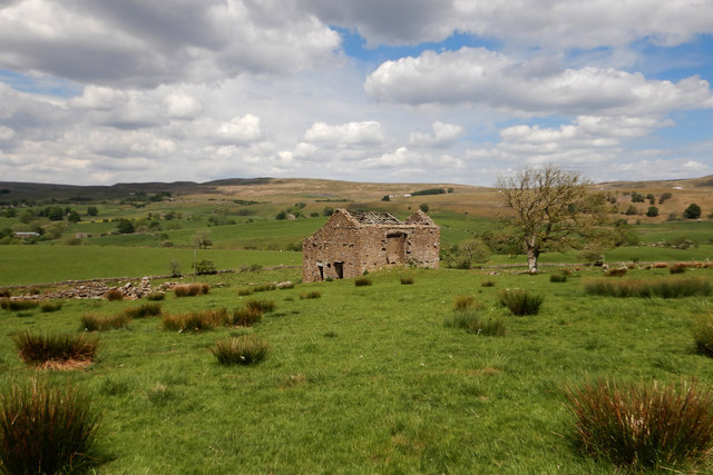
Image: © Andy Waddington Taken: 2 Jun 2020
There is a public footpath descending this hillside past the old barn, though there is scant evidence of it on the ground. If the routes you want are unfrequented (pretty much our objective during coronavirus lockdown) and difficult-to-follow footpaths, then the farmland around South Stainmore offers rich opportunities for binocular-assisted location of stiles and footpath markers and a number of footpaths that aren't quite where shown on the map. Ahead of us here, the way descends towards Argill Beck, where the nature reserve has far more paths - both public and permissive - which have seen much more traffic. In the distance, the A66 transpennine route is far enough away for traffic noise not to be noticeable, though the road is also quieter owing to the reduction in heavy traffic during the pandemic. A few big trucks can be made out labouring up the long incline towards Stainmore summit with the hills of the Army's Warcop training area even further away in the shadow of clouds on the left horizon.
Images are licensed for reuse under creativecommons.org/licenses/by-sa/2.0
Image Location
Latitude
54.515841
Longitude
-2.240319