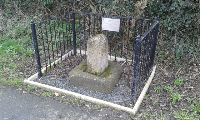
Old Wayside Cross
Introduction
The photograph on this page of Old Wayside Cross by D Garside as part of the Geograph project.
The Geograph project started in 2005 with the aim of publishing, organising and preserving representative images for every square kilometre of Great Britain, Ireland and the Isle of Man.
There are currently over 7.5m images from over 14,400 individuals and you can help contribute to the project by visiting https://www.geograph.org.uk

Image: © D Garside Taken: 8 Jan 2019
Walkington Cross, a wayside cross with an old shaft & base. Set in a hedge with railings around on the south side of the B1230 Beverley Road on the eastern side of the village in Walkington parish. King Athelstan visited Beverley in the 10th century to solicit support from St John of Beverley (who died in 721) in his campaign to subdue northern Britain. Following his success, he granted the town enhanced sanctuary boundaries, marking four main roads with crosses around a mile and a half from the Minster where legend tells us he provided a Frith Stool (means peace and protection in Old English) for miscreants to claim sanctuary. A Scheduled Monument https://historicengland.org.uk/listing/the-list/list-entry/1012591. Milestone Society National ID: YEER_BEV03

