Path to the supermarket, Chase Farm
Introduction
The photograph on this page of Path to the supermarket, Chase Farm by Alan Murray-Rust as part of the Geograph project.
The Geograph project started in 2005 with the aim of publishing, organising and preserving representative images for every square kilometre of Great Britain, Ireland and the Isle of Man.

There are currently over 7.5m images from over 14,400 individuals and you can help contribute to the project by visiting https://www.geograph.org.uk
Path to the supermarket, Chase Farm
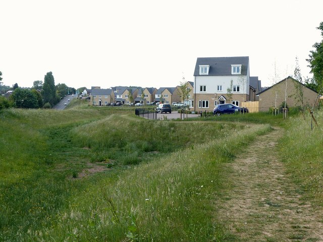
Image: © Alan Murray-Rust Taken: 30 May 2020
An inanity of the car-based, enclosed area thought behind many modern housing developments. The local supermarket is around 150 metres behind the photographer. Because the estate is surrounded by a fence, the official pedestrian route involves walking up the to point on the main road on the left where some blue flags are visible, before coming all the way back down. From the nearest house this is just over 1 kilometre. The path leads to a gate in the fence which is clearly meant to be a locked access to the area around the catchment pond on the left. (It wasn't locked when I was there, but there was someone working on the 'wrong' side of the fence.) If the fence is intended to protect residents from the perils of the pond, the absurdity of this is that the pond is not fenced off from the road.
Images are licensed for reuse under creativecommons.org/licenses/by-sa/2.0
Image Location
Latitude
52.98156
Longitude
-1.087539