Rhiw'r Cwar
Introduction
The photograph on this page of Rhiw'r Cwar by Alan Richards as part of the Geograph project.
The Geograph project started in 2005 with the aim of publishing, organising and preserving representative images for every square kilometre of Great Britain, Ireland and the Isle of Man.

There are currently over 7.5m images from over 14,400 individuals and you can help contribute to the project by visiting https://www.geograph.org.uk
Rhiw'r Cwar
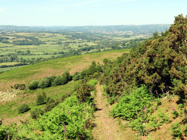
Image: © Alan Richards Taken: 30 May 2020
Llwybr yn mynd i lawr y waered ar lethrau Graig Fawr. Gelwir y goriwaered hwn yn lleol yn Rhiw'r Cwar oherwydd i anhedd-dy (Ynys House) neu anhedd-dai i lawr yn y cwm gael eu hadeiladu gan gerrig o gwar bach a leolir ar ben y tyle. A path descending the slopes of Graig Fawr (trans. big hill). Known locally as Rhiw'r Cwar (trans. quarry hill) as a property (Ynys house) or properties in the valley were built from stone extracted from the small quarry located at the top of the hill.
Images are licensed for reuse under creativecommons.org/licenses/by-sa/2.0
Image Location


Leaflet Map data © OpenStreetMap
Latitude
51.738597
Longitude
-4.018102