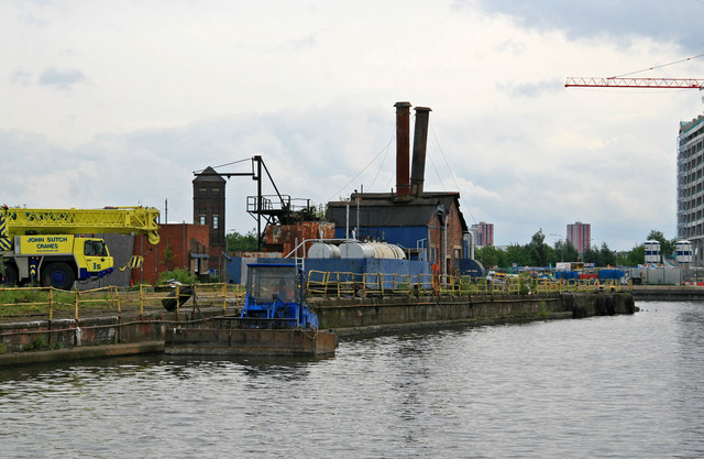
Former Manchester Dry Docks
Introduction
The photograph on this page of Former Manchester Dry Docks by Chris Allen as part of the Geograph project.
The Geograph project started in 2005 with the aim of publishing, organising and preserving representative images for every square kilometre of Great Britain, Ireland and the Isle of Man.
There are currently over 7.5m images from over 14,400 individuals and you can help contribute to the project by visiting https://www.geograph.org.uk

Image: © Chris Allen Taken: 7 Jun 2009
These Dry Docks opened in 1894 and finally closed in 2007, becoming a wet dock. The leaning chimneys are on the boiler house that fed steam to the dewatering pumps right up to the end of operations. The pumps were in an underground chamber and by 2009 they may have been flooded. By 2020 the aerial views show that the boiler house has gone and the fate of the pumps is not known. The other tall tower is on the opposite side of the Manchester Ship Canal as it enters the docks and was the hydraulic accumulator tower for Mode Wheel Locks.

