Old Boundary Marker
Introduction
The photograph on this page of Old Boundary Marker by Mike Rayner as part of the Geograph project.
The Geograph project started in 2005 with the aim of publishing, organising and preserving representative images for every square kilometre of Great Britain, Ireland and the Isle of Man.

There are currently over 7.5m images from over 14,400 individuals and you can help contribute to the project by visiting https://www.geograph.org.uk
Old Boundary Marker
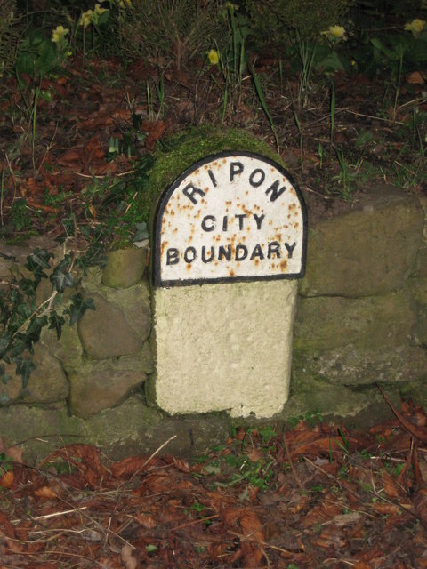
Image: © Mike Rayner Taken: 3 Jan 2019
Municipal Boundary Marker on the east side of the A6108 Palace Road, near High Common Farm, against the stone wall around a flower bed at the foot of a Welcome to Ripon road sign. On the boundary of Ripon and North Stainley with Sleningford parishes. RIPON / CITY / BOUNDARY in raised lettering. See also http://www.geograph.org.uk/photo/4874494. Milestone Society National ID: YW_RIPON01pb
Images are licensed for reuse under creativecommons.org/licenses/by-sa/2.0
Image Location
Latitude
54.150651
Longitude
-1.531615