Old Boundary Marker
Introduction
The photograph on this page of Old Boundary Marker by D Garside as part of the Geograph project.
The Geograph project started in 2005 with the aim of publishing, organising and preserving representative images for every square kilometre of Great Britain, Ireland and the Isle of Man.

There are currently over 7.5m images from over 14,400 individuals and you can help contribute to the project by visiting https://www.geograph.org.uk
Old Boundary Marker
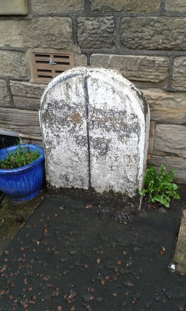
Image: © D Garside Taken: 7 Jan 2016
Parish Boundary Marker against the front wall of 347 Rock Terrace on the east side of the A616 New Mill Road, Brockholes. On the former boundary of Honley and Thurstonland townships, now in Holme Valley parish. Inscribed Boundary of Honley │ Boundary of Thurstonland / 1829 (below both and across the vertical line). Grade II Listed https://historicengland.org.uk/listing/the-list/list-entry/1134808. Milestone Society National ID: YW_KIR03pb
Images are licensed for reuse under creativecommons.org/licenses/by-sa/2.0
Image Location
Latitude
53.594774
Longitude
-1.77271