High Street, Nantwich ? 1963
Introduction
The photograph on this page of High Street, Nantwich ? 1963 by Alan Murray-Rust as part of the Geograph project.
The Geograph project started in 2005 with the aim of publishing, organising and preserving representative images for every square kilometre of Great Britain, Ireland and the Isle of Man.

There are currently over 7.5m images from over 14,400 individuals and you can help contribute to the project by visiting https://www.geograph.org.uk
High Street, Nantwich ? 1963
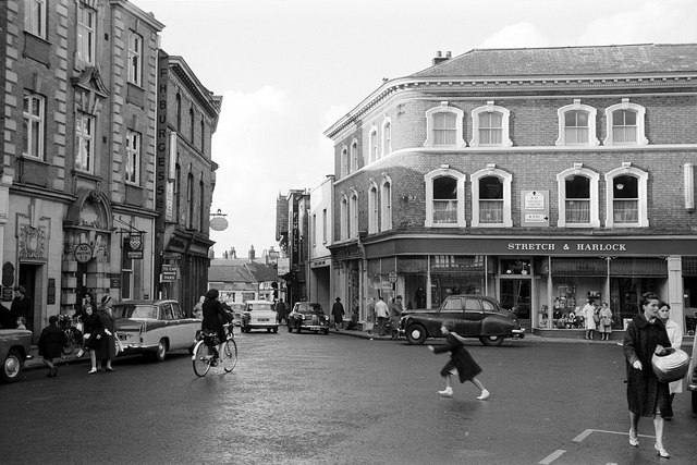
Image: © Alan Murray-Rust Taken: 15 Sep 1963
Still forming part of the A51 through the town, as part of a one-way system, although through traffic was routed via Millstone Lane and Beam Bridge. Still a bit of a free-for-all for motor vehicles, cyclists and pedestrians. Today the whole area is pedestrianised.
Images are licensed for reuse under creativecommons.org/licenses/by-sa/2.0
Image Location
Latitude
53.06733
Longitude
-2.522586