Calanais/Callanish XIII, Calanais, Isle of Lewis
Introduction
The photograph on this page of Calanais/Callanish XIII, Calanais, Isle of Lewis by Claire Pegrum as part of the Geograph project.
The Geograph project started in 2005 with the aim of publishing, organising and preserving representative images for every square kilometre of Great Britain, Ireland and the Isle of Man.

There are currently over 7.5m images from over 14,400 individuals and you can help contribute to the project by visiting https://www.geograph.org.uk
Calanais/Callanish XIII, Calanais, Isle of Lewis
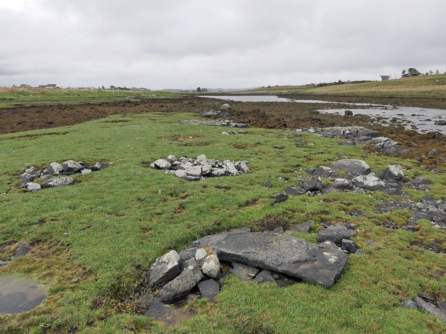
Image: © Claire Pegrum Taken: 22 May 2019
This stone setting lies on a small island in Tòb na Faodhail and is described in the 1976 edition of Discovery and Excavation in Scotland as, "Four low piles of rounded stones; a hollow between them; a prostrate slab lying on the NW pile; all within an area 4m square. The rectangular slab, 1.30m x 0.55m x 0.09m (average), appears to have been worked".
Images are licensed for reuse under creativecommons.org/licenses/by-sa/2.0
Image Location


Leaflet Map data © OpenStreetMap
Latitude
58.2076
Longitude
-6.742257