Hospital Street, Nantwich ? 1963
Introduction
The photograph on this page of Hospital Street, Nantwich ? 1963 by Alan Murray-Rust as part of the Geograph project.
The Geograph project started in 2005 with the aim of publishing, organising and preserving representative images for every square kilometre of Great Britain, Ireland and the Isle of Man.

There are currently over 7.5m images from over 14,400 individuals and you can help contribute to the project by visiting https://www.geograph.org.uk
Hospital Street, Nantwich ? 1963
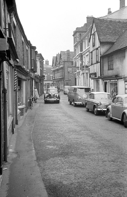
Image: © Alan Murray-Rust Taken: 15 Sep 1963
Still part of the A51 through the town, with no restrictions on traffic, although it was part of a one-way scheme. (Through traffic on the A51 could bypass the town centre via Beam Bridge and Millstone Lane.) Even as late as 1963 there was no pavement on the south side of the road.
Images are licensed for reuse under creativecommons.org/licenses/by-sa/2.0
Image Location
Latitude
53.066346
Longitude
-2.52138