Ornate gateway in Cemetery Road
Introduction
The photograph on this page of Ornate gateway in Cemetery Road by Marathon as part of the Geograph project.
The Geograph project started in 2005 with the aim of publishing, organising and preserving representative images for every square kilometre of Great Britain, Ireland and the Isle of Man.

There are currently over 7.5m images from over 14,400 individuals and you can help contribute to the project by visiting https://www.geograph.org.uk
Ornate gateway in Cemetery Road
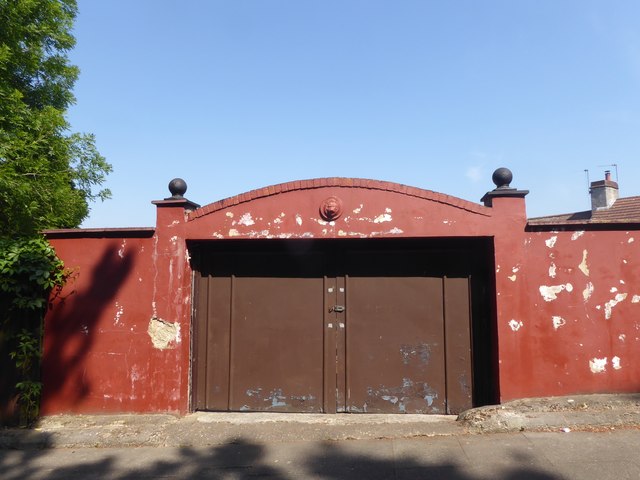
Image: © Marathon Taken: 21 May 2020
This gateway is in Cemetery Road opposite Plumstead Cemetery and not far from the impressive gateway of the cemetery. The Green Chain Walk follows Cemetery Road between East Wickham Open Space and Bostall Woods but why this rather ornate, if run down, gateway is here when the rest of this side of Cemetery Road is nondescript, as seen in the image on Streetview, I have no idea: https://www.google.co.uk/maps/@51.475912,0.109215,3a,75y,68.77h,94.91t/data=!3m6!1e1!3m4!1sQSNWmShwpbMCS8DSrU1rkg!2e0!7i16384!8i8192
Images are licensed for reuse under creativecommons.org/licenses/by-sa/2.0
Image Location
Latitude
51.476029
Longitude
0.109694