Edmondsley Reedbeds
Introduction
The photograph on this page of Edmondsley Reedbeds by Barry Wood as part of the Geograph project.
The Geograph project started in 2005 with the aim of publishing, organising and preserving representative images for every square kilometre of Great Britain, Ireland and the Isle of Man.

There are currently over 7.5m images from over 14,400 individuals and you can help contribute to the project by visiting https://www.geograph.org.uk
Edmondsley Reedbeds
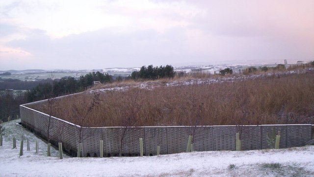
Image: © Barry Wood Taken: 3 Jan 2008
Polluted minewater enters the Congburn stream. It is filtered by the reeds. The water is cleansed and returned to the stream. The reeds thrive on the pollutants.The reeds encourage wildlife.
Images are licensed for reuse under creativecommons.org/licenses/by-sa/2.0
Image Location
Latitude
54.836553
Longitude
-1.641103