
The Eddington development, Cambridge - a blot on the landscape?
Introduction
The photograph on this page of The Eddington development, Cambridge - a blot on the landscape? by Martin Tester as part of the Geograph project.
The Geograph project started in 2005 with the aim of publishing, organising and preserving representative images for every square kilometre of Great Britain, Ireland and the Isle of Man.

There are currently over 7.5m images from over 14,400 individuals and you can help contribute to the project by visiting https://www.geograph.org.uk
The Eddington development, Cambridge - a blot on the landscape?
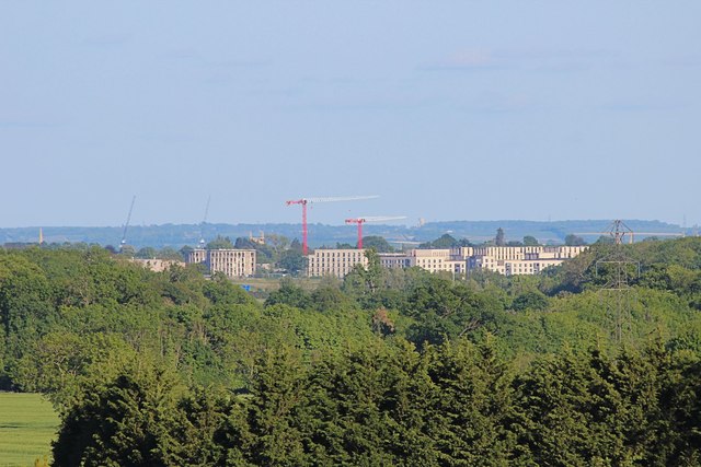
Image: © Martin Tester Taken: 14 May 2020
A blot or not it is certainly obtrusive. This is the view from almost 3 miles away from the footpath near the end of Pettitt's lane, Dry Drayton. The good news is that in cloudy weather it doesn't stick out so much. The Eddington development ( https://eddington-cambridge.co.uk/ ) is a £1bn development by the University of Cambridge primarily to provide homes for staff & students, with schooling & retail facilities. It is situated in the NW of the city on former green-belt land bounded by Madingley & Huntingdon Roads & the M11.
Images are licensed for reuse under creativecommons.org/licenses/by-sa/2.0
Image Location

Latitude
52.218873
Longitude
0.085285