Farmland near Ettingshall Park, Wolverhampton
Introduction
The photograph on this page of Farmland near Ettingshall Park, Wolverhampton by Roger Kidd as part of the Geograph project.
The Geograph project started in 2005 with the aim of publishing, organising and preserving representative images for every square kilometre of Great Britain, Ireland and the Isle of Man.

There are currently over 7.5m images from over 14,400 individuals and you can help contribute to the project by visiting https://www.geograph.org.uk
Farmland near Ettingshall Park, Wolverhampton
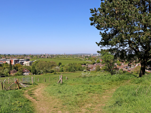
Image: © Roger Kidd Taken: 6 May 2020
Looking north from the track leading down Beacon Hill towards Wolverhampton Road. The Beacon Centre for the Blind is on the left. https://www.beaconvision.org/locations/sedgley-2/ The four tower blocks in Heath Town can be seen. Centrally, on the skyline is the Victoria Hall student accommodation tower block. To the left of that are the city incinerator chimney, the Mander Centre car park, the dark tower of St Peter's Church, Mander House and then the spire of St John's in the Square.
Images are licensed for reuse under creativecommons.org/licenses/by-sa/2.0
Image Location
Latitude
52.554849
Longitude
-2.121342