Craggwood Allotments, Outwood Lane, Horsforth
Introduction
The photograph on this page of Craggwood Allotments, Outwood Lane, Horsforth by Rich Tea as part of the Geograph project.
The Geograph project started in 2005 with the aim of publishing, organising and preserving representative images for every square kilometre of Great Britain, Ireland and the Isle of Man.

There are currently over 7.5m images from over 14,400 individuals and you can help contribute to the project by visiting https://www.geograph.org.uk
Craggwood Allotments, Outwood Lane, Horsforth
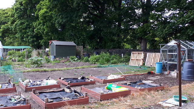
Image: © Rich Tea Taken: 13 May 2020
Looking over the wall shown in Image During the Covid-19 lockdown, some allotment holders are unable to leave home to tend their allotments. Plot no 1 is one of those, and the previous day it had been weeded by some other members, and the beds covered in plastic sheet to suppress weeds until the allotment holder is able to tend it again. On the other hand, many of the allotments are getting more attention than usual, due to the restrictions on other activities during the lockdown. At the start of the lockdown the Government minister Michael Gove was asked about allotments on 2 BBC news programs, and stated that tending allotments was one of the permitted forms of exercise. Note the pallets by the greenhouse, which are very useful for compost bins. 4 pallets joined in a square make a good sized compost bin, with another 3 making a second bin alongside.
Images are licensed for reuse under creativecommons.org/licenses/by-sa/2.0
Image Location


Leaflet Map data © OpenStreetMap
Latitude
53.832274
Longitude
-1.625122