Old Boundary Marker
Introduction
The photograph on this page of Old Boundary Marker by Mike Rayner as part of the Geograph project.
The Geograph project started in 2005 with the aim of publishing, organising and preserving representative images for every square kilometre of Great Britain, Ireland and the Isle of Man.

There are currently over 7.5m images from over 14,400 individuals and you can help contribute to the project by visiting https://www.geograph.org.uk
Old Boundary Marker
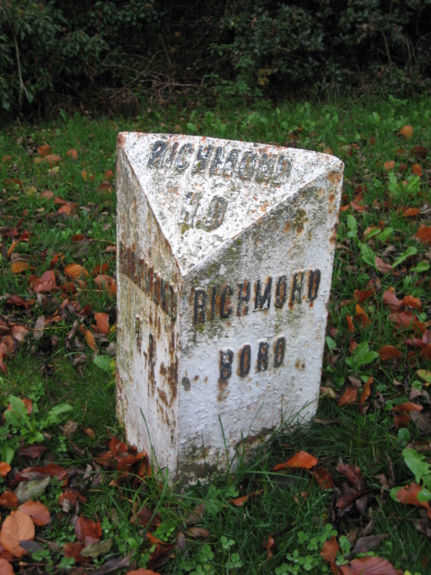
Image: © Mike Rayner Taken: 17 Nov 2019
Municipal Boundary Marker on the north verge of the A6108 Darlington Road, east of its junction with Mile Planting. Closer to the road than YN_RCDL02pb https://www.geograph.org.uk/photo/6472206. On the boundary of Richmond and Easby parishes. In raised lettering RICHMOND / HD (Highway District) and RICHMOND / BORO on adjacent faces and RICHMOND / H.D on its top. This has been moved from the south side of the road where it is shown on old OS maps - Richmond town/borough is to the left of the marker as it stands now. Grade II Listed https://historicengland.org.uk/listing/the-list/list-entry/1179632. See also https://www.geograph.org.uk/photo/2193451 and https://www.geograph.org.uk/photo/1198493. Milestone Society National ID: YN_RCDL01apb
Images are licensed for reuse under creativecommons.org/licenses/by-sa/2.0
Image Location
Latitude
54.410941
Longitude
-1.712034