Old Boundary Marker
Introduction
The photograph on this page of Old Boundary Marker by Mike Rayner as part of the Geograph project.
The Geograph project started in 2005 with the aim of publishing, organising and preserving representative images for every square kilometre of Great Britain, Ireland and the Isle of Man.

There are currently over 7.5m images from over 14,400 individuals and you can help contribute to the project by visiting https://www.geograph.org.uk
Old Boundary Marker
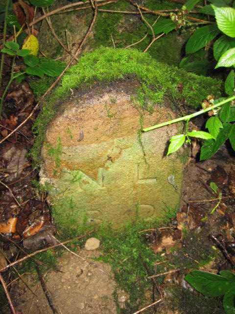
Image: © Mike Rayner Taken: 1 Aug 2019
Municipal Boundary Marker in Flatts Lane Country Park, south of Flatts Lane (the path), at the foot of a tree. Now on the border of Guisborough parish and an unparished part of Redcar and Cleveland borough. Inscribed N.L. / B.D. (Normanby Local Board District). Grade II Listed https://historicengland.org.uk/listing/the-list/list-entry/1329549. Milestone Society National ID: YN_NLBD03pb
Images are licensed for reuse under creativecommons.org/licenses/by-sa/2.0
Image Location
Latitude
54.539899
Longitude
-1.150688