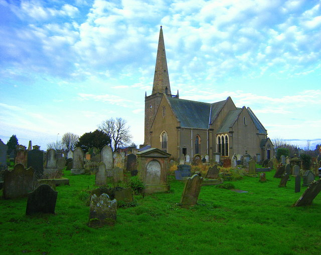
Bangor Abbey and graveyard
Introduction
The photograph on this page of Bangor Abbey and graveyard by Rossographer as part of the Geograph project.
The Geograph project started in 2005 with the aim of publishing, organising and preserving representative images for every square kilometre of Great Britain, Ireland and the Isle of Man.
There are currently over 7.5m images from over 14,400 individuals and you can help contribute to the project by visiting https://www.geograph.org.uk

Image: © Rossographer Taken: 2 Jan 2008
Bangor Abbey was established by Saint Comgall in 558. Little remains of the original abbey after repeated attacks by the Danes, who destroyed it in 824. It was restored by Saint Malachy in the 12th century, although the only structure remaining from this period is thought to be a nearby wall seen in Image The oldest parts of the existing Abbey are thought to date from the 14th Century. The graveyard contains a number of interesting graves and gravestones. I have photographed a few 18th Century examples here: Image Image Image Image If you are looking for a particular gravestone look at the excellent archive of Bill Cardwell at http://www.graves.homecall.co.uk/BangorAbbey/FrameSet.htm .

