Kenilworth Road, roadworks
Introduction
The photograph on this page of Kenilworth Road, roadworks by E Gammie as part of the Geograph project.
The Geograph project started in 2005 with the aim of publishing, organising and preserving representative images for every square kilometre of Great Britain, Ireland and the Isle of Man.

There are currently over 7.5m images from over 14,400 individuals and you can help contribute to the project by visiting https://www.geograph.org.uk
Kenilworth Road, roadworks
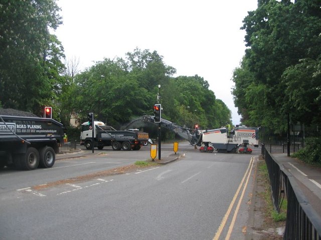
Image: © E Gammie Taken: 10 May 2020
A road planer at work removing the old surface during re-surfacing works at the crossroads of the A45 and Kenilworth Road (A429). The junction and approaches were closed from 6pm 10th May to 6am 11th May to do the work.
Images are licensed for reuse under creativecommons.org/licenses/by-sa/2.0
Image Location
Latitude
52.386424
Longitude
-1.534923