Sedimentary strata
Introduction
The photograph on this page of Sedimentary strata by Anthony O'Neil as part of the Geograph project.
The Geograph project started in 2005 with the aim of publishing, organising and preserving representative images for every square kilometre of Great Britain, Ireland and the Isle of Man.

There are currently over 7.5m images from over 14,400 individuals and you can help contribute to the project by visiting https://www.geograph.org.uk
Sedimentary strata
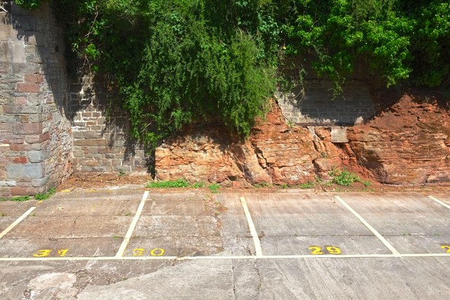
Image: © Anthony O'Neil Taken: 9 May 2020
Evidence of the geological basis of the naming of this area of Bristol - 'Redcliffe'. Ironically, having originated through the steady accumulation of sand grains, on the ocean floor, the resulting rock has been mined and crushed to return it to sand for building. The historic 'caves' created by this industrial process are still partially accessible, nearby, at Redcliffe Quay.
Images are licensed for reuse under creativecommons.org/licenses/by-sa/2.0
Image Location
Latitude
51.447555
Longitude
-2.593095