Marwolaeth Tref? - The Death of a Town?
Introduction
The photograph on this page of Marwolaeth Tref? - The Death of a Town? by Alan Fryer as part of the Geograph project.
The Geograph project started in 2005 with the aim of publishing, organising and preserving representative images for every square kilometre of Great Britain, Ireland and the Isle of Man.

There are currently over 7.5m images from over 14,400 individuals and you can help contribute to the project by visiting https://www.geograph.org.uk
Marwolaeth Tref? - The Death of a Town?
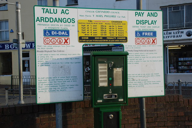
Image: © Alan Fryer Taken: 2 Jan 2008
One of the factors quoted for the decline of town-centre trade in Pwllheli is the recent massive increase in parking charges. Here on Y Maes, the market square at the centre of town, the charges show the winter rates. During the summer charging period (most of the year) the maximum £5.30 shown here will increase to £7.50. For comments see Image
Images are licensed for reuse under creativecommons.org/licenses/by-sa/2.0
Image Location


Leaflet Map data © OpenStreetMap
Latitude
52.887437
Longitude
-4.418459