116 Clarence Road
Introduction
The photograph on this page of 116 Clarence Road by Ian Capper as part of the Geograph project.
The Geograph project started in 2005 with the aim of publishing, organising and preserving representative images for every square kilometre of Great Britain, Ireland and the Isle of Man.

There are currently over 7.5m images from over 14,400 individuals and you can help contribute to the project by visiting https://www.geograph.org.uk
116 Clarence Road
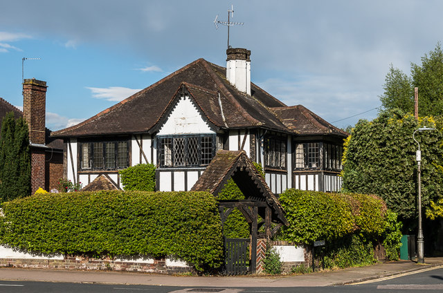
Image: © Ian Capper Taken: 1 May 2020
House at the corner of Clarence Road and Jennings Road, in an area that started development in the late 19th Century of fields previously belonging to St Peter’s Farm, part of the larger Earl Spencer Estate. However, this particular plot appears to have remained empty until around the 1930s. Locally listed.
Images are licensed for reuse under creativecommons.org/licenses/by-sa/2.0
Image Location
Latitude
51.756874
Longitude
-0.320622