Old tidal basin of shipyard
Introduction
The photograph on this page of Old tidal basin of shipyard by Lairich Rig as part of the Geograph project.
The Geograph project started in 2005 with the aim of publishing, organising and preserving representative images for every square kilometre of Great Britain, Ireland and the Isle of Man.

There are currently over 7.5m images from over 14,400 individuals and you can help contribute to the project by visiting https://www.geograph.org.uk
Old tidal basin of shipyard
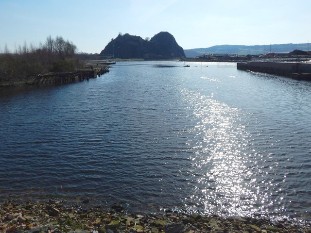
Image: © Lairich Rig Taken: 22 Mar 2020
The view is to the right (south) from a Image As the map shows, Image, now culverted for most of its length, flows into the River Leven here. The basin was not present when the first-edition OS map was surveyed in 1862, but appeared in its present form on the map revision of c.1896. MacMillan's shipyard was at this end of the basin, but was later replaced by Ballantine's distillery, itself now demolished to make way for housing and a Image The Denny shipyard was further downriver, on the land that can be seen in the left background: Image Dumbarton Rock is prominent in the background. The tip of Image is in front of the right-hand side of the Rock. Behind that, and forming the skyline in the right-hand half of the picture, is land on the other side of the River Clyde. (*) On MacMillan's shipyard (or "McMillan's" — the spelling of the surname varies and is of little consequence), see Image / Image / Image / Image
Images are licensed for reuse under creativecommons.org/licenses/by-sa/2.0
Image Location
Latitude
55.941577
Longitude
-4.564663