Old Boundary Marker
Introduction
The photograph on this page of Old Boundary Marker by R Mills as part of the Geograph project.
The Geograph project started in 2005 with the aim of publishing, organising and preserving representative images for every square kilometre of Great Britain, Ireland and the Isle of Man.

There are currently over 7.5m images from over 14,400 individuals and you can help contribute to the project by visiting https://www.geograph.org.uk
Old Boundary Marker
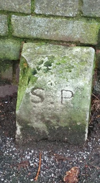
Image: © R Mills Taken: 18 Feb 2020
Parish Boundary Marker standing against a brick garden wall on the south side of Westmead Road, just west of its junction with The Crescent and west of SY_CARSUT03pb in Carshalton. Inscribed S P / 1894 for Sutton parish. Milestone Society National ID: SY_CARSUT04pb
Images are licensed for reuse under creativecommons.org/licenses/by-sa/2.0
Image Location
Latitude
51.365707
Longitude
-0.181734