The Walled Garden, Silverburn Park
Introduction
The photograph on this page of The Walled Garden, Silverburn Park by Bill Kasman as part of the Geograph project.
The Geograph project started in 2005 with the aim of publishing, organising and preserving representative images for every square kilometre of Great Britain, Ireland and the Isle of Man.

There are currently over 7.5m images from over 14,400 individuals and you can help contribute to the project by visiting https://www.geograph.org.uk
The Walled Garden, Silverburn Park
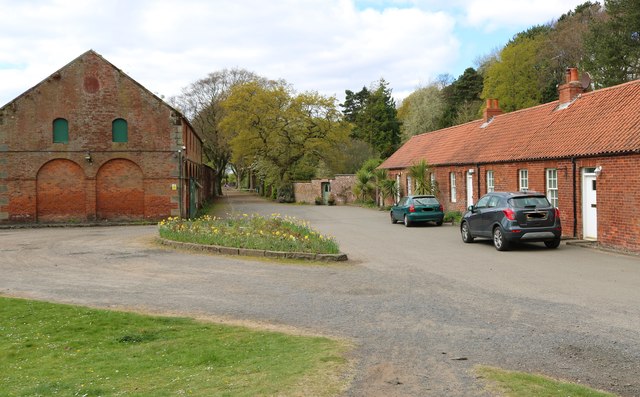
Image: © Bill Kasman Taken: 26 Apr 2020
The main entrance to the walled garden is in the centre of the image. The cottages on the right used to be occupied by estate workers but are now private residences. The building on the left is a former flax mill. See Walled Garden article: https://www.geograph.org.uk/article/The-Walled-Garden-Silverburn-Park
Images are licensed for reuse under creativecommons.org/licenses/by-sa/2.0
Image Location
Latitude
56.206351
Longitude
-2.979089