Old Boundary Marker
Introduction
The photograph on this page of Old Boundary Marker by M Bardell as part of the Geograph project.
The Geograph project started in 2005 with the aim of publishing, organising and preserving representative images for every square kilometre of Great Britain, Ireland and the Isle of Man.

There are currently over 7.5m images from over 14,400 individuals and you can help contribute to the project by visiting https://www.geograph.org.uk
Old Boundary Marker
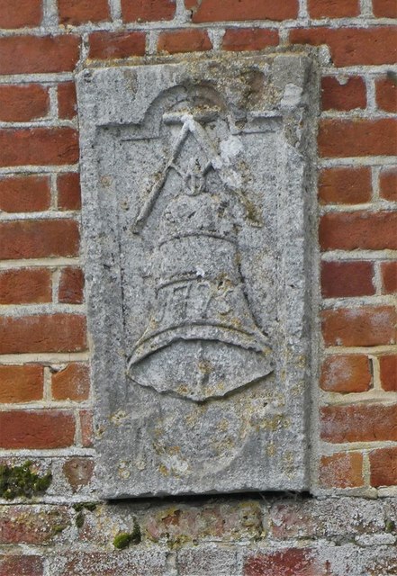
Image: © M Bardell Taken: 12 Nov 2019
Bridge Marker set in south bridge parapet of Nayland Bridge, River Stour. NAYLAND WITH WISSINGTON parish. A / 1775 in relief. Nayland Bridge is also called Bell Bridge and Anchor Bridge and was built in 1775 to replace a wooden one given by nearby clothier in Nayland named John Abell, who died in 1524. The bridge is Grade II Listed https://historicengland.org.uk/listing/the-list/list-entry/1222738. Milestone Society National ID: SU_NAYL02br
Images are licensed for reuse under creativecommons.org/licenses/by-sa/2.0
Image Location
Latitude
51.969745
Longitude
0.872087