Kinson: Durdells Gardens
Introduction
The photograph on this page of Kinson: Durdells Gardens by Chris Downer as part of the Geograph project.
The Geograph project started in 2005 with the aim of publishing, organising and preserving representative images for every square kilometre of Great Britain, Ireland and the Isle of Man.

There are currently over 7.5m images from over 14,400 individuals and you can help contribute to the project by visiting https://www.geograph.org.uk
Kinson: Durdells Gardens
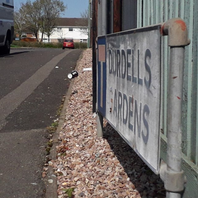
Image: © Chris Downer Taken: 13 Apr 2020
Durdells Gardens is the next junction along from Durdells Avenue rather than a turning off it, as might be expected. It is a modern-ish (perhaps later 1970s) cul-de-sac of terraced houses, the likes of which we can glimpse in the background. The sign is the standard Bournemouth nameplate from the 1980s, affixed with tubular steel which protrudes at each side. For cul-de-sacs, it is common for these to incorporate the no-through road sign, as here. This is photo no.121 of a series of 453 in my coronavirus lockdown walking project: See https://www.geograph.org.uk/article/My-2020-Coronavirus-Lockdown-walking-project for the complete set of photos.
Images are licensed for reuse under creativecommons.org/licenses/by-sa/2.0
Image Location
Latitude
50.764185
Longitude
-1.909769