Old Boundary Marker
Introduction
The photograph on this page of Old Boundary Marker by S Penhallurick as part of the Geograph project.
The Geograph project started in 2005 with the aim of publishing, organising and preserving representative images for every square kilometre of Great Britain, Ireland and the Isle of Man.

There are currently over 7.5m images from over 14,400 individuals and you can help contribute to the project by visiting https://www.geograph.org.uk
Old Boundary Marker
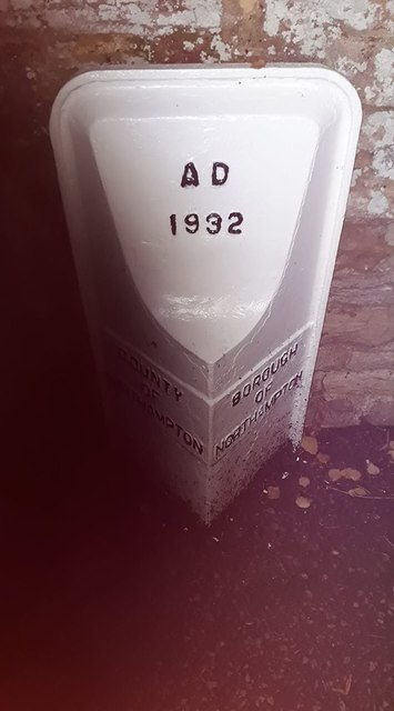
Image: © S Penhallurick Taken: 12 Oct 2019
Municipal Boundary Marker set against a high stone wall on the east side of the junction of Church Way and High Street, Northampton, south of St Peters Church. COUNTY / OF / NORTHAMPTON and BOROUGH / OF / NORTHAMPTON on adjacent faces and A D / 1932 on its head face. See also http://www.geograph.org.uk/photo/5990008. Milestone Society National ID: NR_NOTON01pb
Images are licensed for reuse under creativecommons.org/licenses/by-sa/2.0
Image Location
Latitude
52.249101
Longitude
-0.846588