Old Boundary Marker
Introduction
The photograph on this page of Old Boundary Marker by Mike Rayner as part of the Geograph project.
The Geograph project started in 2005 with the aim of publishing, organising and preserving representative images for every square kilometre of Great Britain, Ireland and the Isle of Man.

There are currently over 7.5m images from over 14,400 individuals and you can help contribute to the project by visiting https://www.geograph.org.uk
Old Boundary Marker
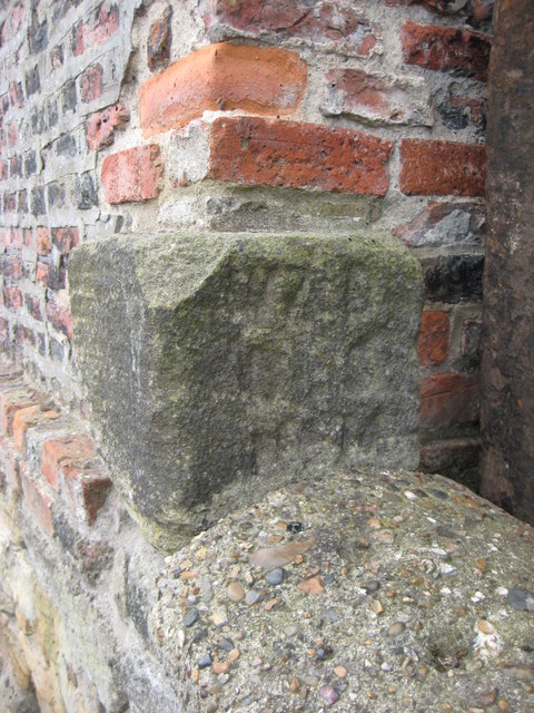
Image: © Mike Rayner Taken: 21 Jul 2019
War Department Boundary Marker set in the west face of the northwest corner of the site of Cliffords Fort and Ballards smokehouse, Union Road, North Shields. It’s at the foot of a brick wall where it ends above a stone wall. Inscribed W ↑ D / BS / No. 16. Grade II Listed https://historicengland.org.uk/listing/the-list/list-entry/1299778. Milestone Society National ID: NB_WDNSH16em
Images are licensed for reuse under creativecommons.org/licenses/by-sa/2.0
Image Location
Latitude
55.010456
Longitude
-1.433057