The Priory, Prestbury
Introduction
The photograph on this page of The Priory, Prestbury by Philip Halling as part of the Geograph project.
The Geograph project started in 2005 with the aim of publishing, organising and preserving representative images for every square kilometre of Great Britain, Ireland and the Isle of Man.

There are currently over 7.5m images from over 14,400 individuals and you can help contribute to the project by visiting https://www.geograph.org.uk
The Priory, Prestbury
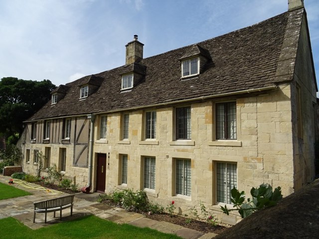
Image: © Philip Halling Taken: 15 Aug 2019
The Priory viewed here from the churchyard of St Mary's church. At the time of the dissolution of the monasteries this building was part of the Augustinian Llanthony Priory. The building is Grade II listed, see: https://historicengland.org.uk/listing/the-list/list-entry/1091902
Images are licensed for reuse under creativecommons.org/licenses/by-sa/2.0
Image Location
Latitude
51.914611
Longitude
-2.04575