Benchmark on Ironmould Lane
Introduction
The photograph on this page of Benchmark on Ironmould Lane by Neil Owen as part of the Geograph project.
The Geograph project started in 2005 with the aim of publishing, organising and preserving representative images for every square kilometre of Great Britain, Ireland and the Isle of Man.

There are currently over 7.5m images from over 14,400 individuals and you can help contribute to the project by visiting https://www.geograph.org.uk
Benchmark on Ironmould Lane
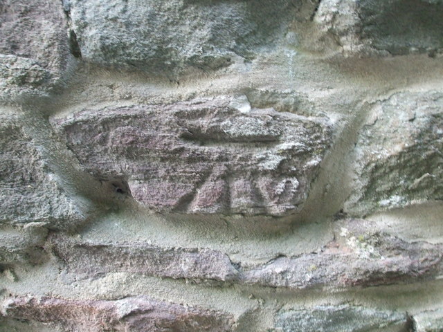
Image: © Neil Owen Taken: 25 Apr 2020
This cutmark is relatively new, being made after WWII. However, the fresh-looking mortar gives the impression the wall has been rebuilt afterwards. See Image] for a wider view and https://www.bench-marks.org.uk/bm119448 for the entry in the Benchmark Database.
Images are licensed for reuse under creativecommons.org/licenses/by-sa/2.0
Image Location
Latitude
51.433559
Longitude
-2.530193