Herbert Crescent
Introduction
The photograph on this page of Herbert Crescent by Martin Addison as part of the Geograph project.
The Geograph project started in 2005 with the aim of publishing, organising and preserving representative images for every square kilometre of Great Britain, Ireland and the Isle of Man.

There are currently over 7.5m images from over 14,400 individuals and you can help contribute to the project by visiting https://www.geograph.org.uk
Herbert Crescent
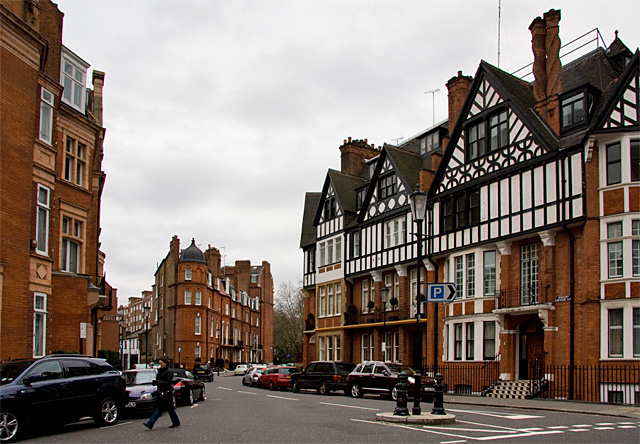
Image: © Martin Addison Taken: 31 Dec 2007
The buildings on the right form part of Herbert Crescent, which diverges to the right from Pavilion Road at the block of buildings in the centre-left of the photo - Pavilion Road continues straight on. This view is from Hans Crescent.
Images are licensed for reuse under creativecommons.org/licenses/by-sa/2.0
Image Location
Latitude
51.499096
Longitude
-0.159963