Arrochar
Introduction
The photograph on this page of Arrochar by Bill Kasman as part of the Geograph project.
The Geograph project started in 2005 with the aim of publishing, organising and preserving representative images for every square kilometre of Great Britain, Ireland and the Isle of Man.

There are currently over 7.5m images from over 14,400 individuals and you can help contribute to the project by visiting https://www.geograph.org.uk
Arrochar
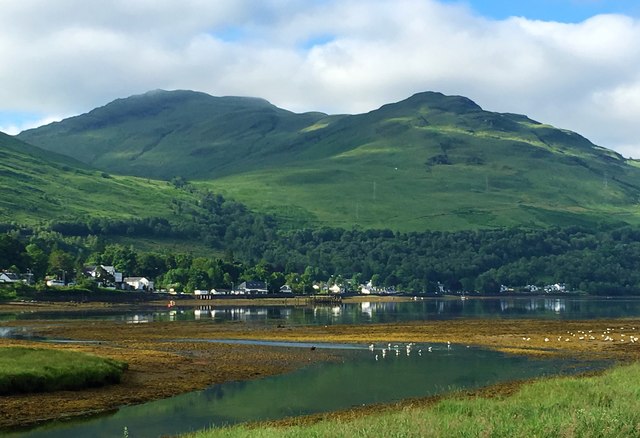
Image: © Bill Kasman Taken: 26 Jun 2016
Seen from across the head of Loch Long. The peak on the right is Monadh Tighe na Laraich (447m) and that on the left is Ben Reoch (660m).
Images are licensed for reuse under creativecommons.org/licenses/by-sa/2.0
Image Location
Latitude
56.196134
Longitude
-4.747849