Albert Road North
Introduction
The photograph on this page of Albert Road North by Ian Capper as part of the Geograph project.
The Geograph project started in 2005 with the aim of publishing, organising and preserving representative images for every square kilometre of Great Britain, Ireland and the Isle of Man.

There are currently over 7.5m images from over 14,400 individuals and you can help contribute to the project by visiting https://www.geograph.org.uk
Albert Road North
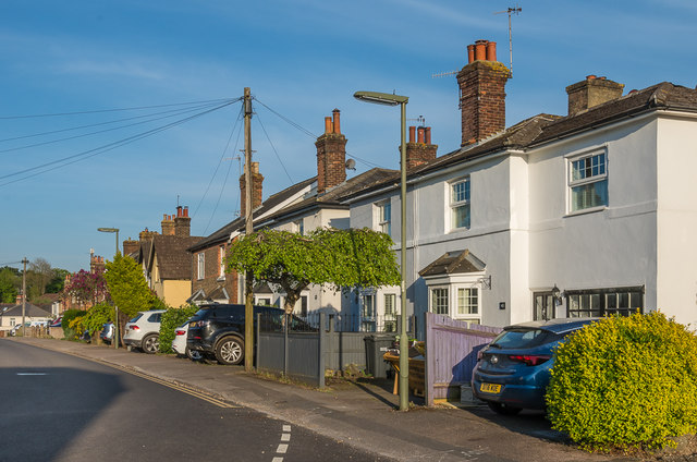
Image: © Ian Capper Taken: 21 Apr 2020
Late Victorian housing - it is shown partly developed on the 1871-2 1:2,500 map, with the gaps shown as having been largely filled by the 1896 edition. In the former map it is shown as North Albert Road; by the time of the 1896 map it had been renamed with its present name, Albert Road North. The pair on the right of the photo, nos 41 - 43, served as the original Reigate Cottage Hospital from 1866 - 1871, one of the earliest cottage hospitals in the country.
Images are licensed for reuse under creativecommons.org/licenses/by-sa/2.0
Image Location
Latitude
51.242444
Longitude
-0.213907