Confused of Croydon
Introduction
The photograph on this page of Confused of Croydon by Peter Trimming as part of the Geograph project.
The Geograph project started in 2005 with the aim of publishing, organising and preserving representative images for every square kilometre of Great Britain, Ireland and the Isle of Man.

There are currently over 7.5m images from over 14,400 individuals and you can help contribute to the project by visiting https://www.geograph.org.uk
Confused of Croydon
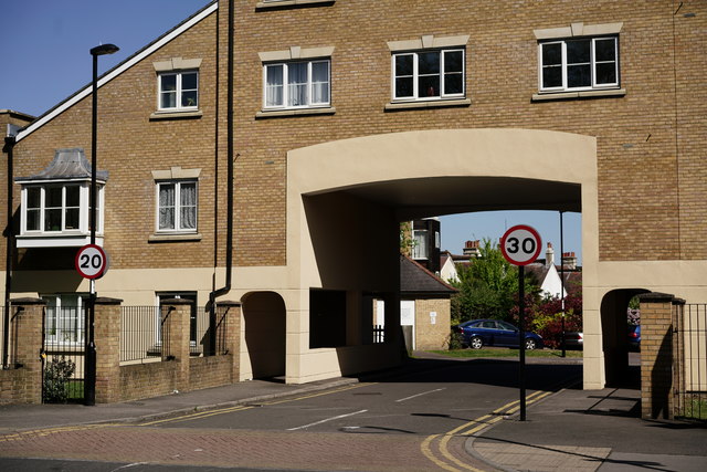
Image: © Peter Trimming Taken: 19 Apr 2020
East India Way leads to housing on the site of the former Addiscombe railway station. The speed limit should be 20mph, whilst the main road has a limit of 30mph; I suspect that the sign has been rotated.
Images are licensed for reuse under creativecommons.org/licenses/by-sa/2.0
Image Location
Latitude
51.379321
Longitude
-0.081856