The Stables, Grafton Street
Introduction
The photograph on this page of The Stables, Grafton Street by Sue Adair as part of the Geograph project.
The Geograph project started in 2005 with the aim of publishing, organising and preserving representative images for every square kilometre of Great Britain, Ireland and the Isle of Man.

There are currently over 7.5m images from over 14,400 individuals and you can help contribute to the project by visiting https://www.geograph.org.uk
The Stables, Grafton Street
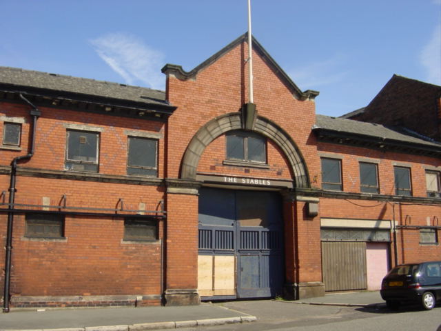
Image: © Sue Adair Taken: 15 Aug 2005
Simply bearing the name 'The Stables' and are shown as such on the 1908 map they are adjacent to the Mersey Brewery and built of the same brick. The stables were assumed to have been for dray horses in the 19th and 20th centuries.
Images are licensed for reuse under creativecommons.org/licenses/by-sa/2.0
Image Location
Latitude
53.39113
Longitude
-2.977355