The Green at Anstey
Introduction
The photograph on this page of The Green at Anstey by Mat Fascione as part of the Geograph project.
The Geograph project started in 2005 with the aim of publishing, organising and preserving representative images for every square kilometre of Great Britain, Ireland and the Isle of Man.

There are currently over 7.5m images from over 14,400 individuals and you can help contribute to the project by visiting https://www.geograph.org.uk
The Green at Anstey
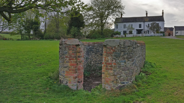
Image: © Mat Fascione Taken: 17 Apr 2020
The stone structure is probably a former pinfold or animal pound. The house in the background is the Manor Farmhouse.
Images are licensed for reuse under creativecommons.org/licenses/by-sa/2.0
Image Location
Latitude
52.673011
Longitude
-1.196321