
A9 Double Bridges at Culmaily, Sutherland
Introduction
The photograph on this page of A9 Double Bridges at Culmaily, Sutherland by Andrew Tryon as part of the Geograph project.
The Geograph project started in 2005 with the aim of publishing, organising and preserving representative images for every square kilometre of Great Britain, Ireland and the Isle of Man.

There are currently over 7.5m images from over 14,400 individuals and you can help contribute to the project by visiting https://www.geograph.org.uk
A9 Double Bridges at Culmaily, Sutherland
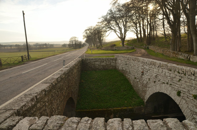
Image: © Andrew Tryon Taken: 5 Apr 2020
Two stone arch bridges over the Culmaily Burn watercourse, near Golspie village, Scottish Highlands. The bridge on the left carries the A9 trunk road, the main link through this part of Scotland. The road is very quiet because this photograph was taken during the UK Coronavirus lockdown of 2020. The bridge on the right would have once carried the A9 before it was straightened. Now it is just used by farm traffic.
Images are licensed for reuse under creativecommons.org/licenses/by-sa/2.0
Image Location

Latitude
57.964785
Longitude
-4.017613