View from Gallions Hill
Introduction
The photograph on this page of View from Gallions Hill by Marathon as part of the Geograph project.
The Geograph project started in 2005 with the aim of publishing, organising and preserving representative images for every square kilometre of Great Britain, Ireland and the Isle of Man.

There are currently over 7.5m images from over 14,400 individuals and you can help contribute to the project by visiting https://www.geograph.org.uk
View from Gallions Hill
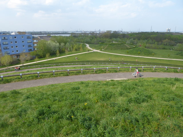
Image: © Marathon Taken: 11 Apr 2020
Gallions Hill is a sixty feet high landmark created from "recycled excavated material". A spiral path leads to the summit which provides widespread views up and down the Thames. To the south the views are only as far as the ridge between Shooters Hill, Plumstead Common, Bostall Heath and Lesnes Abbey Woods. This view looks over a newly-created park with the River Thames just beyond and the Barking Creek Barrier far right on the horizon.
Images are licensed for reuse under creativecommons.org/licenses/by-sa/2.0
Image Location
Latitude
51.503521
Longitude
0.091079