Old Boundary Markers
Introduction
The photograph on this page of Old Boundary Markers by P Winnett as part of the Geograph project.
The Geograph project started in 2005 with the aim of publishing, organising and preserving representative images for every square kilometre of Great Britain, Ireland and the Isle of Man.

There are currently over 7.5m images from over 14,400 individuals and you can help contribute to the project by visiting https://www.geograph.org.uk
Old Boundary Markers
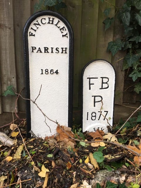
Image: © P Winnett Taken: 23 Nov 2019
Parish Boundary Markers in front of a fence on the access road beside Halfords and off the east side of the A1000 High Road. On the former boundary of Finchley and Friern Barnet parishes. MX_BARN03pb in raised lettering FINCHLEY / PARISH 1864 and HE_BARN02pb in recessed lettering F B / P / 1877. See also http://www.geograph.org.uk/photo/4786716. Milestone Society National ID: HE_BARN02pb on the right and MX_BARN03pb on the left.
Images are licensed for reuse under creativecommons.org/licenses/by-sa/2.0
Image Location
Latitude
51.635223
Longitude
-0.176135