Old Milestone by the former A388, Higher New Bridge
Introduction
The photograph on this page of Old Milestone by the former A388, Higher New Bridge by Rosy Hanns as part of the Geograph project.
The Geograph project started in 2005 with the aim of publishing, organising and preserving representative images for every square kilometre of Great Britain, Ireland and the Isle of Man.

There are currently over 7.5m images from over 14,400 individuals and you can help contribute to the project by visiting https://www.geograph.org.uk
Old Milestone by the former A388, Higher New Bridge
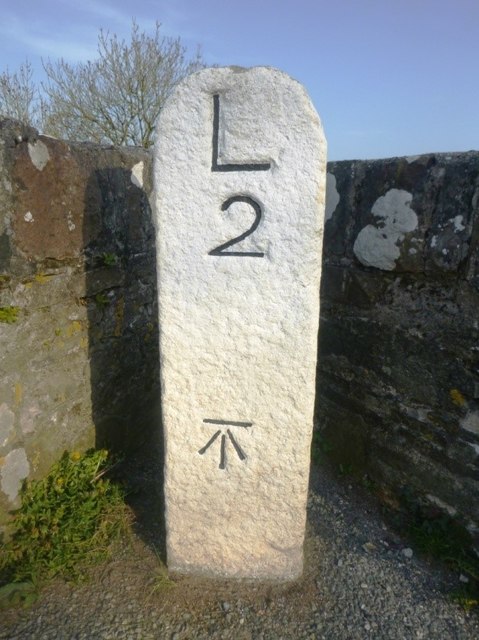
Image: © Rosy Hanns Taken: 22 Apr 2019
Carved stone post by the A388, in parish of ST STEPHENS BY LAUNCESTON RURAL (NORTH CORNWALL District), Higher New Bridge, in Western cutwater refuge of bridge dated "circa 1504", on Northwest side of road. Launceston pillar, erected by the Launceston turnpike trust in the 18th century. Inscription reads:- L 2 Carved benchmark on lower face. Grade II listed. List Entry Number: 1310378 https://historicengland.org.uk/listing/the-list/list-entry/1310378 Milestone Society National ID: CW_LAHO02.
Images are licensed for reuse under creativecommons.org/licenses/by-sa/2.0
Image Location
Latitude
50.656441
Longitude
-4.337255