Boundary Wall for Tong Castle and remains of pulpit
Introduction
The photograph on this page of Boundary Wall for Tong Castle and remains of pulpit by Richard Law as part of the Geograph project.
The Geograph project started in 2005 with the aim of publishing, organising and preserving representative images for every square kilometre of Great Britain, Ireland and the Isle of Man.

There are currently over 7.5m images from over 14,400 individuals and you can help contribute to the project by visiting https://www.geograph.org.uk
Boundary Wall for Tong Castle and remains of pulpit
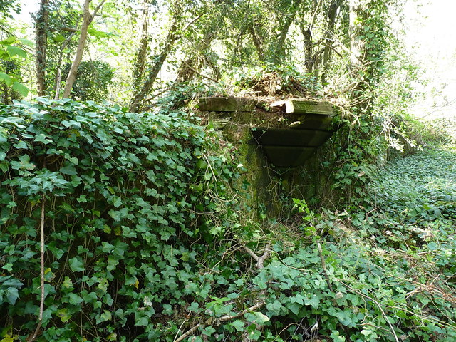
Image: © Richard Law Taken: 11 Apr 2020
The remains of this sandstone wall are dated to 1821, but the ashlar pulpit seen here is roughly 55 years older than that, and is thought to be the work of 'Capability' Brown; part of the boundary of the long demolished Tong Castle which lay about half a mile to the WNW of here. The whole remnant was Grade II listed https://britishlistedbuildings.co.uk/101176593-wall-with-remains-of-pulpit-approximately-10-metres-to-east-of-convent-lodge-tong#.XpNvwshKjcs & https://historicengland.org.uk/listing/the-list/list-entry/1176593 in 1955. The style of the wall is better seen in Image, and is similar to another remnant at Image
Images are licensed for reuse under creativecommons.org/licenses/by-sa/2.0
Image Location


Leaflet Map data © OpenStreetMap
Latitude
52.656657
Longitude
-2.299173