Belvoir High School, Bottesford
Introduction
The photograph on this page of Belvoir High School, Bottesford by Kate Jewell as part of the Geograph project.
The Geograph project started in 2005 with the aim of publishing, organising and preserving representative images for every square kilometre of Great Britain, Ireland and the Isle of Man.

There are currently over 7.5m images from over 14,400 individuals and you can help contribute to the project by visiting https://www.geograph.org.uk
Belvoir High School, Bottesford
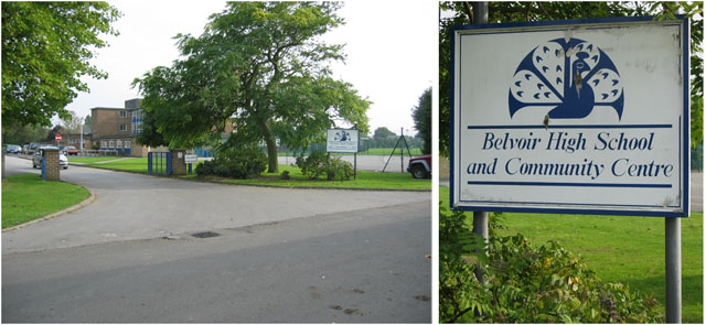
Image: © Kate Jewell Taken: 11 Oct 2005
This High School takes students from10+ up to the year before Key Stage 4 (GCSE). They then transfer to the Upper School in Melton, 18 miles away. It's not surprising that the catchment area is campaigning for full secondary status. Note the school emblem! (Update Nov 2007: As part of a major reorganisation of the Melton and Vale of Belvoir education provision Belvoir High has gained approval to become a 11+ to 19 trust school.)
Images are licensed for reuse under creativecommons.org/licenses/by-sa/2.0
Image Location
Latitude
52.937031
Longitude
-0.809635