Flattened weighbridge building
Introduction
The photograph on this page of Flattened weighbridge building by Richard Sutcliffe as part of the Geograph project.
The Geograph project started in 2005 with the aim of publishing, organising and preserving representative images for every square kilometre of Great Britain, Ireland and the Isle of Man.

There are currently over 7.5m images from over 14,400 individuals and you can help contribute to the project by visiting https://www.geograph.org.uk
Flattened weighbridge building
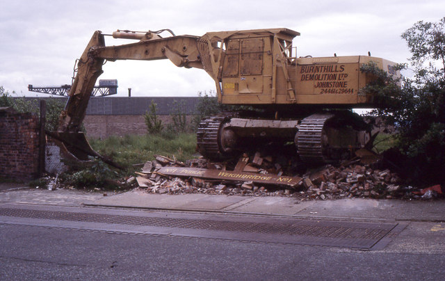
Image: © Richard Sutcliffe Taken: Unknown
The machine is sitting on top of a pile of rubble - all that remains of Public Weighbridge No 1 on St Vincent Crescent. It was being demolished in preparation for building on what is today Minerva Way. The actual weighbridge can be seen in the foreground. In the far distance is the Finnieston Crane. Up until 1960 the area behind the weighbridge was Stobcross Goods and Mineral Yard, with many railway sidings. Scanned from a Kodachrome colour reversal (slide) film.
Images are licensed for reuse under creativecommons.org/licenses/by-sa/2.0
Image Location
Latitude
55.86325
Longitude
-4.28396