Blind Man's Corner
Introduction
The photograph on this page of Blind Man's Corner by Sean Davis as part of the Geograph project.
The Geograph project started in 2005 with the aim of publishing, organising and preserving representative images for every square kilometre of Great Britain, Ireland and the Isle of Man.

There are currently over 7.5m images from over 14,400 individuals and you can help contribute to the project by visiting https://www.geograph.org.uk
Blind Man's Corner
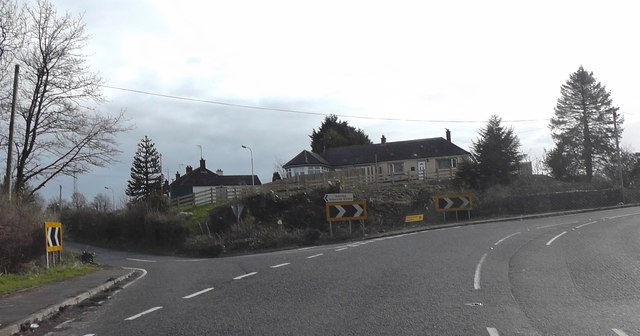
Image: © Sean Davis Taken: 18 Mar 2020
This sharp bend on the A29 (Armagh to Keady road) is known locally as "The Blind Man's Corner". He is said to have sat on the wall at the right of the photo. The road to the left is the Batchelor's Walk.
Images are licensed for reuse under creativecommons.org/licenses/by-sa/2.0
Image Location
Latitude
54.266163
Longitude
-6.689333