Cambuslang Industrial Estate
Introduction
The photograph on this page of Cambuslang Industrial Estate by Lairich Rig as part of the Geograph project.
The Geograph project started in 2005 with the aim of publishing, organising and preserving representative images for every square kilometre of Great Britain, Ireland and the Isle of Man.

There are currently over 7.5m images from over 14,400 individuals and you can help contribute to the project by visiting https://www.geograph.org.uk
Cambuslang Industrial Estate
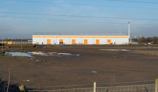
Image: © Lairich Rig Taken: 3 Feb 2006
Much of the site was still undeveloped when this picture was taken; this view would now be impossible because of intervening buildings. The picture was taken from the nearby cycle path, and the stripes on the building's roof allow the viewpoint to be determined fairly accurately. The then-undeveloped area in front of the building is shown separately from another angle in Image, taken on the same day. By 2020, when these pictures were submitted, that area had long since been occupied by additional buildings of the industrial estate. The first-edition map (surveyed in 1858) shows a farm called Bogleshole at about Image, now roughly the northern end of the estate. The Clyde Iron Works Colliery, shown on OS maps from the second edition (1898) onwards, was near Image The chimney on the right is not part of this building, but belongs to the more distant Image
Images are licensed for reuse under creativecommons.org/licenses/by-sa/2.0
Image Location
Latitude
55.825962
Longitude
-4.174321