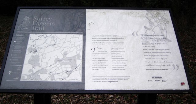
Surrey Diggers Trail
Introduction
The photograph on this page of Surrey Diggers Trail by Sean Davis as part of the Geograph project.
The Geograph project started in 2005 with the aim of publishing, organising and preserving representative images for every square kilometre of Great Britain, Ireland and the Isle of Man.
There are currently over 7.5m images from over 14,400 individuals and you can help contribute to the project by visiting https://www.geograph.org.uk

Image: © Sean Davis Taken: 20 Feb 2007
This information board is opposite a bus shelter at the entrance of the car park to Weybridge Train Station. A memorial stone to Gerrard Winstanley is just behind it. The Surrey Diggers (or True Levellers as they called themselves) was a movement started in 1649 by Gerrard Winstanley two months after the execution of King Charles I. Winstanley was a cloth trader from Lancashire whose business in London was ruined by the English Civil War. He moved to Cobham where he stayed with friends and earned his living as a farm labourer. Through a vision he claimed to have, together with stories from many others who were also left with nothing, he produced writings about the rights of the common man. A lot of these were merely pamphlets. The one below was entitled "The New Law of Righteousness" and was published in January 1649. "When this universal law of equity rises up in every man and woman, then none shall lay claim to any creature and say, This is mine, and that is yours. This is my work, that is yours. But everyone shall put their hands to till the earth and bring up cattle, and the blessing of the earth shall be common to all; when a man hath need of any corn or cattle, take from the next storehouse he meets with. There shall be no buying or selling, no fairs or markets, but the whole earth shall be a common treasury for every man, for the earth is the Lord's... When a man hath eat, and drink, and clothes, he hath enough." He earned a following through his radical views, believing common land belonged to everyone and thus everyone had a right to earn a livelihood from it. With people from Walton and Cobham he set up a commune at St Georges Hill on 1st April 1649. They built places for their families to live and dug the land to plant their crops. They were poor and at first thought harmless, so were left to their own devices. It wasn't long before wealthy landowners and people in power realised their threat. Those who felt threatened by the Diggers paid local thugs to beat them up, destroy their crops and burn their houses. They and their families were taken prisoner and locked up in St Mary's at Walton. They were eventually released as there were no grounds to hold them. They moved to Cobham and gained support from other corners of the country where communes were also set up. However, they never stood a chance against the might of those in control and within three years of starting they were quashed and became a part of history. Until recently this was a part of England's history which has not been given much credit. However, it resurfaced almost 350 years later on 3rd April 1995 when a band of modern day Eco Warriors and historians marched from Walton to St George's Hill in remembrance to "the Diggers". They camped there for a time before they were removed. Their intention was to erect a memorial stone to "the Diggers". The story of this part of history has been documented by the BBC, h2g2 and by Elmbridge Museum. A Diggers Trail has since been established see https://www.diggerstrail.org.uk/ The local council eventually agreed for a memorial stone to "Gerrard Winstanley a True Leveller" to be erected on Cobbett's Hill just opposite Weybridge railway station and on the fringes of St Georges Hill. For a photo of the memorial stone see https://www.geograph.org.uk/photo/6433963 Some songs have been written about this time in English history. You can listen to different versions of Digger's Songs at http://www.seedstar.net/undeep/diggers.html and at https://www.youtube.com/watch?v=OA4FTIz2Zrw

