Westhumble Chapel
Introduction
The photograph on this page of Westhumble Chapel by Sean Davis as part of the Geograph project.
The Geograph project started in 2005 with the aim of publishing, organising and preserving representative images for every square kilometre of Great Britain, Ireland and the Isle of Man.

There are currently over 7.5m images from over 14,400 individuals and you can help contribute to the project by visiting https://www.geograph.org.uk
Westhumble Chapel
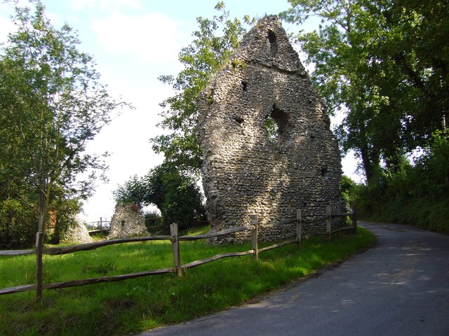
Image: © Sean Davis Taken: 28 Jun 2007
Ruins of 12th century Westhumble Chapel. Now cared for by the National Trust and on the route of London Green Belt Way. To read National Trust notice see https://www.geograph.org.uk/photo/6432263
Images are licensed for reuse under creativecommons.org/licenses/by-sa/2.0
Image Location
Latitude
51.254838
Longitude
-0.339251